Monday, June 27, 2016

June 26, 2016  Harper's Ferry, West Virginia
  Yesterday's event of crossing the Shenandoah River is a big deal for the thru-hiker. We finally are out of Virginia, having traversed 555 miles of trail in one state, a full quarter of the length of the Appalachian Trail. I can finally, after one month, now say that I woke up in a state other than Virginia. Yes Virginia, there really is a northern border, and I just crossed it. Hasta la vista, baby!
  Meghan and I successfully traversed the Shenandoah National Park. I am going to let her blog about this much more eloquently than I. We covered the 110 miles in all in 9 days, averaging 13 miles per day, and one new foot blister per day for Meghan, one very nasty large one under her great toe nail, (where have I seen that before?) She and I had a wonderful time as she tested new limits under less than ideal boot conditions, but we finished a day relier than expected, with the bonus that we are still on speaking terms. It was a very special and wonderful time for me, and I was genuinely impressed with her strength and determination and have no doubt that if one day she too chose to thru-hike, she could accomplish this this without question.
Leaving Shenandoah National Park

  I arranged to have Meghan picked up by a shuttle person in Front Royal. We came into the town the night before and stayed at a wonderful up and coming B+B/hostel, Mountain Home, just steps way from the AT itself. Scott Jenkins and his wife are restoring a beautiful old southern mansion, a previous plantation. At this point, there was only one small cabin that could accommodate 6 hikers for bed, linens, shower and breakfast. They gave us a shuttle to town where we did laundry and went out to a pub for dinner and beer with another thru-hiker, Omh-pie.
  I set out on the trail, determined to cover the 15 miles to Dick's Dome shelter. I know that I now need to step up the mileage a bit as the heat of summer in the south is fast approaching. The day was warm, but not hot, but very humid. The hike up from Manassus Gap proved more difficult than usual as there were many trees down over the trail, likely caught up in an a micro-burst in the violent storms we experienced 2-3 days prior. Trail Crews from the PATC had yet to get out to clear the carnage.

I reached my destination before 4PM. The shelter is dome like but hard to describe. As it turned out, I met a trail crew regional boss from PATC there, 'Sisue', who told me the shelter was slated for demolition as it was too difficult to maintain. Instead he showed me the new post and beam shelter, the shelter at Whiskey Hollow, being built just steps away that will house 12 hikers. Sean and I had spent a miserable night in the dome 9 years ago weathering out another violent thunder storm with 4 other people crammed into the very confined space. I cannot say that I am sorry the shelter is slated to go. I spent a pleasant evening with a grampa and his 12 year old grandson out for a 3-4 day trip to Bear's Den. You mean, Grampas can do that to their grandchildren? Once again that night, 4-5 night hikers arrived at 11:30 PM. This time though, they had the courtesy to set up tents a distance from the shelter and were not that disruptive.
  The next day, I got up at 6, in order to be on the trail early. I knew I had the Virginia Roller-coaster to deal with. In the past, the trail followed 8 miles along a busy road to reach the Bear's Den ATC hostel. When they negotiated with land owners a route in the woods, the only land offered was over the crest and valleys of the adjacent hills. This leads to 9 ups and downs over 9 miles with gains in elevation of up to 600' at a time. It is considered some of the most challenging terrain Virginia has to offer. It continues another 4 miles beyond the hostel as well, before the trail evens out to a much more steady and level ground.
RollerCoaster

  The day brought me through a high meadow that was part of a state park. The view was beautiful. Along the way I encountered trail magic, hosted by a couple who were motorcycle enthusiasts. They had first encountered hikers after setting up their own lunch on the Blue Ridge Mountain Parkway, and being confused by passing hikers as offering trail magic. I am not sure how they beat off the hungry hikers, without loosing their lunch. At this trail magic, a bear chose to investigate. I got within 50 yards and noted he was probably a yearling and posed no real threat. He was easily scared off. Eat your heart out, Meg.
  Along the way, we passed the 1000 mile marker . This was only the first of our 'emotional' halfway points. Harper's is considered the halfway point as well, but the true halfway point this year is some 70 miles north of the Potomac River and Harpers Ferry, and changes year to year as trail relocations are done. The year of 2007 the trial's official length was 2174,; this year it is 2189!

     By the time I reached Bear's Den Hostel, I was a sweaty mess. Once again the shower was  a lifesaver. The old mansion was built as a summer home and the wife a concert pianist. A special piano room was built where she conducted recitals. The building is beautiful stone with a stone fence all around. The hiker special for $30 includes bed with linens, shower, laundry, a meal of frozen large pizza and a pint of ice cream, as well as a make your own pancake breakfast in the morning. There I once again met Hazelnut, a Maine hiker from Bridgeton, whom I had met weeks ago at Jerry's Cabin in the middle of the North Carolina wilderness.

 Yesterday, we once again stepped it up with a 20 mile hike into Harper's Ferry. Here I have sheltered with a fiend of Kathy's whom she met at Katahdin in a wildlife photography group. Terri now lives in Harper's Ferry area, but grew up in Calais, Maine. She volunteers for the ATC, and has been section hiking the AT with her partner, Marie for years. She occasionally takes in stray dogs, as well as stray hikers like myself. The hike to town was much more reasonable and flat, covering the distance before 3PM. After arriving in town, my first order of business was to replace my hiking shoes. The shoes I bought in Hot Springs owed me nothing and had lasted almost 800 miles. I went to the ATC center and registered, and was photographed there as was the tradition for all thru-hikers. I found the old picture of Sean and myself from 2007, took a photo of that and wasted no time in posting it to Facebook.


  So today, I am taking it easy with a 'zero' down day. This week I plan to step up the mileage even further with the more forgiving less mountainous terrain in Maryland and early Pennsylvania.


Monday, June 13, 2016

June 13, 2016     Waynesboro, Virginia
  A relatively sedate 6 days of hiking has brought me to the gateway of Shenandoah National Park. The hiking scene has been relatively sedate in fact. I wanted to start by giving a tribute to a fellow hiker. Hilda and Bernz were thru-hikers from Germany with whom we overlapped at several shelters, and got to know. Both in their late 60's, were from the middle of Germany " no one has heard of our town". She was remarkable in that she is all of 90 pounds and smokes like a fiend. She does not act like a smoker though, as her pace could put a 20 year old to shame. On a typical 16 mile day, she would arrive in the campsite 90 minutes before I did...and I never stop, just ask my wife. He hiked at a good pace as well but never kept up with her. If she took a break or lunch, she would smoke. I asked her what made her so fast, and she just shrugged.. she did not really have an answer. I was hoping she was a former olympic race-walker, but no such luck. We parted ways at Glasgow as I went to town, and they continued down the trail to go off trail at Buena Vista for resupply and a night in a good bed. I learned yesterday from another thru-hiker that during that night, Bernz died in his sleep. 'Pops', the thru-hiker I met yesterday here, told me he had rented a car to take Hilda to Washington Dulles. It was very sad to hear of his passing as he was a very sweet and lovely gentleman, who loved the outdoors. As trite as it is, he did die doing what he loved the best.
  It was nice to not have any pressure to put in long days and long miles. The plan of days gave me one 18 mile day, and the rest were shorter than that, still giving me almost 3 full days to unwind and relax here in Waynesboro. I am currently at a wonderful B+B, the Tree Street Inn. The home is lovely with a pool, and dates back a hundred years. As it turns out, the hiker rate per night was only $18 more than the Quality Inn, and the breakfasts are so much better. This was truly a no-brainer. Waynesboro is a thriving town with a solid reputation of being hiker friendly. They post a list of 40 or more people and cell numbers for hikers to call who will provide a free ride in from the trail, day or night. They have their own hiker fest celebration this coming weekend.
  Before leaving leaving Glasgow, I could not resist having one more in-town meal at Scotto's Restaurant which had been closed the prior day. A group of us left town: a dad, 'Crunch', who was thru-hiking and his son Matt who had joined him for three weeks. As it turned out, we all had grilled chicken on a salad, and no one had any hamburger or fried items. We also left with 'Ham-Fist', a thru-hiker from Tewksbury, Ma., a 6'4" large and powerful young man. Piney, our shuttle driver, brought us all to trail head and we headed out to a beautiful, low humidity day, for short mileage of only 10 miles to Punchbowl Shelter. I returned to the trail as it coursed along with the Blue Ridge Parkway. The day did include a climb of almost 2000', but it felt very good and was not taxing at all.The ridge we climbed took us over Bluff Mt., and there we found two dead copperhead snakes, that someone had crushed with a rock. It is a very dangerous thing to provoke a snake, unless you successfully kill it. Fall short of that goal, and there might be a problem. In any case, most snakes will not attack unless provoked. Killing the two snakes by a hiker seems senseless and stupid, and reflects some of the hikers out here who do not respect the out doors and are here for the party they are trying to create.
  Punchbowl was a small naturally occurring pond next to the parkway. The setting was perfect and the night quiet. That night a local man hiked into camp, doing a section hike. He had long flowing hair in a Mohawk and carried old-school gear, a rucksack, etc. He made pine needle and beech leaf tea (for the first time) to which he yelled after sipping: 'wow that's good!'. He was gone before first light.
  The following day, I hiked to Cow Camp shelter, or as I refer to it Cow Flop shelter. We got off on the wrong foot initially as I followed Ham-Fist out of camp, and was immediately concerned that we were headed south on the AT. I let it go a while, but within 5", I yelled to Ham my concerns, noting we should cross the parkway road within .5 miles. He wanted me to lead a while which I did for another 5-10", before turning around convinced we had gone the wrong way. None-the-less, he said he wanted to go just a little further to be sure. By the time I returned to the turn-off to the shelter, 30" had elapsed, and I quickly found the right way to the parkway. I can only assume that Ham-Fist has turned around by now, as I have not seen him since.
  This was a 17 mile day to Cow Camp, along the ridge with up and downs, but cool crisp temperatures and a nice breeze feeling almost fall-like. During the hike, I climbed another 2700'. I passed the road US 60, the road to Buena Vista. I recognized the picnic area we used over 22 years ago while on a vacation with our children in the Charlottesville area using a time-share. Here we had met a thru-hiker named David , and offered him lunch. We got to know him, and later picked him up at Katahdin as he finished his hike, housing him for the night in Orono, before his return bus trip home.
  Interestingly, the Cow Camp shelter was .5 miles off the trail. I was the only one in camp that night. No one else came to the shelter or set up a tent there. The grounds were surprisingly clear of litter. The outhouse had no stench, all indicative that the mileage off the trail had discouraged 90% of hikers from coming down to take advantage of the site. There was a wonderful stream in front of the shelter, too cold to immerse oneself, but just right for washing up, and soaking poor tired feet. By contrast though, I could vividly see what a negative impact the Mongol hordes of hikers were having on the more used and accessible shelter sites. That night was very cold, and in my light summer bag, I found myself dawning every warm piece of clothing I still had in my possession.
  By contrast, the following day brought me to the Priest shelter, named after the mountain, not the pastor. The shelter registry was humorous though, as it was labeled 'The Priest confessionals", and some did in vivid detail.The ridge to the Priest included an assent over Cold Mountain, and I wondered if this was the mountain referenced by the novel. The hiking was great over wonderfully graded trails, and the cool temps made it even more perfect. The ridge also took me over Spy Rock, with a commanding view of the valley below. This had in fact had been used as an observation point for troop movements during the Civil War. The Priest shelter filled to capacity by 11 PM with the late arrival of a night hiker. These guys usually don't get started until midday, but still want the big miles and don't really care whose sleep they are disturbing when they arrive in camp. There were also at least 10 other people in tents  that night, telling me that the 'bubble' has not yet completely passed me by. This area was showing signs of use and misuse. The privy was abominal.
  The following days hike to Maupin Field Shelter was perhaps the most strenuous of the week. The first 5 miles saw us drop 3000' in altitude to the Tye River. There, a beautiful pedestrian suspension bridge brought us across the river. We then climbed back the 3000' in altitude to the top of the North Ridge of the Three Ridges. The day was much more humid and warm, making the exercise that much more difficult. The views from the top of the ridge were spectacular though. Maupin was a nice location though, and although there were a lot of tenters, I was the only one to occupy the shelter that night.Once again however, another set of night hikers arrived at 11 PM, but this time set up tents, rather than using the shelter.
  I spent one more night out at the Paul Wolf shelter, just 5 miles short of Rockfish Gap and Waynesboro. There were a few people in camp, and one other section southbounder from Connecticut in the shelter with me. The shelter had a 'double-decker' sleeping area, and a huge decked and covered front deck overlooking the stream. Sensing more biting insects than usual, I chose this time to set up my tent... in the shelter (which worked quite well by the way). Again, there was a wonderful cool stream with pools to just sit in and cool off as reward for staying the night. Most of the younger hikers though pushed through the longer mileage day to get into town.
  The following day was an easy 5 mile hike to the Gap. As I arrived, a trail Angel was dropping two hikers back on the trail. He spotted me, and offered the ride into Waynesboro, 6 miles away. I originally thought with such a short hike on the AT that day, the extra mileage on the road would do me good. However the Angel 'Bill' said he did not want to be alone on the trip back to town so I accepted his offer.
  My daughter arrives in 2 days and we enter Shenandoah Park. After that, I will need to start pushing my mileage northward in order to escape the advancing southern summer and humidity.


Monday, June 6, 2016

June 6, 2016   Glasgow, Virginia
  Another 4 days on the trail has brought me to a resupply point in Glasgow, Va. I hiked in the remaining two miles from Matt's Creek shelter this morning to the town making this a 'Nero' day, that is a day almost all to myself without thought or effort of hiking. Sean and I stayed here 9 years ago in a small no-tell motel, but this has since closed. Several businesses in the downtown  are closed and have been for several years. For hikers however, the town and a boy scout troop, as an eagle project, built a 12 person shelter, complete with a hot water shower and two porta-potties, Nirvana for the average thru-hiker. There's a laundry down the street to complete our experience. While coming here, I crossed the longest pedestrian bridge  on the AT across the James River, built on old abandoned railway pilings. As I reached the opposite shore a shuttle was just delivering two hikers to the trail assuring me of a ride into the town 6 miles away. One of the hikers was 'Fern', a young girl who is from Limerick, Me, and graduated from the University with a degree in kinesiology 3 years ago. It is amazing how many Maine hikers I have met out here so far!
Pedestrian bridge over the James River


  Since leaving Daleville, Virginia has dished out more of the same. The terrain has been difficult, more difficult than I remember, and the weather very humid, which means I am very moist at the end of the day, and in desperate need of a shower by the end of 5 days. Passing by the first shelter out of town, I spoke with a young family on a section hike, with an 11 yo and a 4 yo boy, Josh, who seemed to be a handful! They had found mold in their rented apartment, and were out to clear the air a bit. The youngest had asthma, and since leaving the apartment, while the problem was being fixed, he had required no treatment. Dad was carrying a 4 person Coleman tent, and most of the younger boys possessions by the end of the day. They traveled a little slower, but we did share the same site that first day out.
  At the shelter I once again came across Arkansas Traveler, with whom I had hiked  over three weeks ago. I also hiked several days with 'Popeye', a 66 year old retired vending machine repairman, from Florida, who recently had suffered a stroke, which left him with a facial droop, but  did not prevent him from hitting the trail with the idea of finishing a thru-hike. He carries a Popeye figurene. As I watched him walk, I admired his resilience and courage, as it looked like a struggle for him. Yet even with his mild disability, he was up every day at 6 AM, and put in the same 17-18 mile days I was finishing. He had been off the trail a week due to a deep seated infection in his great toe from an infected blister.
  The second day brought me across the Blue Ridge Mountain Parkway, the first of many crossings over the next 200 miles, of either the Parkway, and later the Skyline Drive through the Shenandoah National Park. The AT originally followed the same ridge of mountains from North Carolina as the Parkway, but was shifted to the range west in the 1930's and 1940's when the parkway was built. The weather was good and much cooler at the 3500' feet elevation. The humidity created an amazing undercast of clouds down below in the valley. The second day brought us to Jennings Creek, and a private campground. They had a pool and showers (never pass up the opportunity to take a shower!), as well as a concession stand, with great hamburgers and fries, with ice cream for dessert.


   I spent much of the next couple of days hiking with Bob, 'Good Heart', who was doing a section hike to Harpers Ferry. He had recently retired from teaching as a computer instructor, but employs 35 people in an IT firm. His son too was an eagle scout and both he and his son had gone to Philmont, in New Mexico.
  It was at this location  that we learned  the Thunder Hill shelter and all camping for 18 miles was closed due to problem bears... bad Yogi!. This forced us to do a short day of hiking to Cornelius Creek, then a long day of 18 miles to Matt's Creek. Despite the relative assurance of guide books showing not much up and down, the amount of climbing proved difficult and repetitive. Though the temperature was reasonable at about 75', the humidity was excessive, and by the time I reached the shelter, I looked like I had jumped in the lake... which I would have gladly done if one had been nearby. There was a full shelter and many other tenters that night, over 20 in all. All of us were bottle-necked here by the 18 mile closure to camping coming up. That night, there was an amazing light and thunder show. The rain came down in torrents and the sky was literally constantly alight with lightening. Luckily none of the tents washed away and all survived the night. As I was in the shelter that night, I thanked my lucky stars for that good fortune.
  The next day, initially looked threatening, but improved as the day went on and never really rained on us. Again we had several short hard climbs, followed by downclimbs. I climber over Apple Orchard Mountain at 4225, the highest we will get yet again to this level will be Mt. Mooselauki in New Hampshire. This mountain once served as a base for a radar installation during the cold war that monitored air traffic up and down the east cost. It is now a communications station for cell and TV. Arriving at Matt's Shelter, there was a rushing stream with deep enough pools to sit in and wash off, a welcome relief.
  Unfortunately, the only restaurant in town is closed on Mondays, so I plan to hang around tomorrow for a 10:30 brunch, then hit the trail to finish another 10 miles out of the 77 remaining over the next 6 days till I reach Rockfish Gap, and Waynesville. There Meghan plans to join me on the 14th for the next 103 miles. More blog to come at that point!


Wednesday, June 1, 2016

June 1, 2016.         Daleville ,Virginia
  Well, more of the same has been going on since I resumed the trail 6 days ago in Pearisburg. I took a wonderful week off and returned to Maine for Sean's graduation from UNE COM. It was wonderful to see family and be home again. We also accomplished a few other things as well. I was able to get over to see my mom who was recently discharged from the hospital after another bout with infection. I got out to camp and got the furniture out, the screens up, the water up and running after finding a huge hole in the copper piping where water had pooled and frozen over the winter. I also got the dock in. At home, I got two cords of wood stacked in the woodshed. Despite the pleasure of being home with my wife, each day there was a sense of unease, like I needed to be doing something else..... like hiking.
  Traveling on a plane, I had to be sure may white gas fuel bottle was empty. As it happened, TSA inspected my backpack both coming and going to be sure I was compliant with this. Before going back, I wanted to be sure I could refill the bottle before resuming the trail. I must have called 10 businesses in Pearisburg, even  Walmart, and all were out of white gas and expecting a delivery. When I landed in Roanoake, with a rental car at my disposal, I quickly shopped at nearby malls for food and found a Dick's Sporting Goods. So 700 cc's of fuel cost me around $14, and thus I had to bite the bullet and bought the entire gallon of Coleman fuel, leaving the rest to the hiker box at the B+B I stayed at in Narrows. Now at least one place in the greater Pearisburg region has white gas. I have since found out that I could have used super unleaded gasoline as a substitute, though MSR does not officially condone or approve of the practice. Who knew?
  In Narrows, Va, I stayed at a wonderful B+B, The MacArthur Inn, named in honor of General Douglas MacArthur. This place was beautiful. Built at the turn of the century, it started out as a hotel, but ended up as a nursing home residence. It was condemned as a a structure unsuitable for this purpose in the 1970's, and was slated to be torn down. The proprietor, Alan, bought the place and with tender-loving care has restored the building back to it's original intent as a hotel. Alan was a  crusty southerner, with a handle bar mustache,  a good heart and a love for hikers and the AT. We shared a bond over restoring old structures. The next morning, he made each of us an omelette, one at a time. It was delicious, and because of the slow, individual production of each breakfast plate, this did take time, and lead to a late start.  I was able to return the rental car to the Enterprise in Pearisburg, then get on the trail by 9:30. Interestingly, in addition to not having any availability to rent cars out of the town, there is also apparently no one working there as the employee had not shown up a half hour after opening time. So I left the key on the desk with the rental agreement and bolted. Message to self; never trust Enterprise Pearisburg again!

  The first day out was quite warm and now humid, a dramatic change from a week before. I decided on an ambitious itinerary of hiking 20 miles to Pine Swamp shelter. What I hadn't counted on was  a degree of  interval deconditioning from not hiking in over a week. The hike out of Pearisburg was long and posed a significant gain in altitude. On reaching the ridge, I went through an area that had no green leaves or anything else green for that matter including the forest floor, likely as a result of very hungry gypsy moth catapillars. There was one improvement though: the mud was significantly reduced. It was a long day, and I pulled into the shelter at 6:30. There I met a  family from Georgia; Mom, Dad, about my age , and their three grown children with their significant others. Most occupied the shelter, but there was a spot for me. They were section hiking together to McAfee's Knob. The father did all the planning, and did most of the food planning, dehydrating, and vacuum packaging. The re-hydrating and cooking turned out to be a little variable with regards to it's intended outcome, but they all ate the food none-the-less. They also were hiking with a black lab, who snorted, licked, and made noise all night long, leading to a restful sleep for myself.

  The following day was also challenging with two separate climbs to 4000', each climb over 2000'. The profile made it look like the walk on top of the ridges would be flat and easy. It did not turn out that way as there were rocks, big and small to contend with and challenge my balance. You have to be carefully watching each and every step, playing hop-scotch with the rocks to ensure your footing is firm and you don't twist the wrong way and fall. I missed my footing on one occasion and fell at an innocuous looking spot, bending the tip of my new pole on impact. I was able to restore functionality, and bend the pole back mostly to straight. Once again, the fall looms as the hikers worst nightmare and adversary. The day was also very warm and humid with dew points around 60'. I went through 5-6 liters of water that day. Rule of thumb: keep the pee as pale as possible! The second climb of the day at 3 PM was miserable, hot and slow. This time though, the ridge was very easy terrain, as was the descent to Laurel Creek shelter. At the road crossing prior to this last climb, I found trail magic with fruit, candy and drinks. I stuffed in my pack what I though was a large red and white can of coke, only to find upon arrival at camp, that it was a Bud, with a July 4th holiday label. I would have preferred coke.
  The next day was overcast on awakening, but it stayed dry. Because of the unusual spacing of shelters, I had to do a 22.5 mile day to stay on schedule. Pickle Branch shelter was the only shelter in a 25 mile stretch. The big climb of the day once again was difficult with the muggy conditions. Once on top, the walking was easy. For many miles, I saw areas where stones had been meticulously piled, likely meaning this had once been a field that a farmer had cleared by hand. The farm land had long ago been reclaimed by the forest. We also climbed Bushey Mountain later in the day, and the walk across the top was a fire road, a welcome relief to the feet. Any rain activity seemed light and it confined itself to the night-time hours.

  The next day looked on paper to be easier, and shorter, only 17 miles. However, the first part of the day was a stiff climb to Dragon's Tooth. As I got higher, the sun came out and I noticed undercast clouds, from condensation of muggy air. The walk across the ridge to Dragon's Tooth was very difficult footing and slower than usual. The view there was spectacular however and worth the effort. Many thru-hikers had camped on top and were making a leisurely morning of it. The first mile of descent was also a rock scramble. By 12:30, after 5 hours of hiking, I noticed that I had only gone 5-6 miles, well off my usual 2-2.5 mph pace. The terrain had been surprisingly difficult. The rest of the day brought me to McAfee's Knob. Reaching the gap and parking lot (on Memorial Day), there must have been 200 cars, (and no trail magic). I found myself on a well traveled fire road with all the tourists and could not believe this was the AT. About a half mile further and upon further questioning of a returning day hiker, I found out that I had missed the turn off for the AT which paralleled the fire road to the same destination. So at that point I could have a) retraced my steps and taken the AT; b) bush-wack down a 45' slope and try to find the AT; or c) keep going. Which to do?... c) of course. A little blue blazing never hurt anyone, and after being beaten up by Dragon's Tooth, it was nice to take the 'easy' way. McAfee's Knob was spectacular, despite being overwhelmed by the tourist traffic. I managed to get a few impressive pictures of myself on the knob with Wilson.

  The shelter was less than a mile away north off the mountain. As the shelter beyond  was closed due to a pesky Yogi Bear, this lead to a bottle-neck of a large group of hikers staying the night. I met a girl who was thru-hiking and had been working for the Green Mountain Club. We had a nice chat about the Long Trail, and adventures there with bears last year.  Two hikers were in camp for the night who were somewhat famous in the thru-hiker bubble. One hiker was detained on several occasions by the Hot Springs Police Department, and he claimed abuse of power and authority. The other hiker seemed to have a similar story and actually eventually became friends with the mayor of the town. One of them also seemed to confirm the rumors we had heard that an angry hiker, harassed unnecessarily by police in Hot Springs, had set off the forest fire there.
  The final day of hiking  15 miles into Daleville brought me to Tinker Cliffs early in the morning. Again the view was spectacular. The rest of the day was uneventful, reaching town by 3:30 for a shower, laundry and dinner out. There I once again ran into 007, a Brit hiking sections of the trail, confounded by orthopedic medical issues, and I had seen in several towns along the way, We had shared our first hitch ride into Hiawassee, Ga. two months ago.

  I have now planned out the next 140 miles which will bring me to Rock Fish Gap and Waynesville, Va., the gateway to the Shenandoah Mountains. My adventurous daughter Meghan will join me there on June 14th for the next hundred miles. She will be the last of my children to be tortured by Dad with a long distance hike, but a time which I greatly look forward to.

Tuesday, May 24, 2016

May 18, 2016,   Pearisburg, Virginia
    As it happens, I made it through the last 10 days on the trail; 10 days without staying in a town. How would I describe it: mud. This seems quite appropriate and fitting. The last 3 weeks have been very wet. Fortunately for me, most of the heavy rain seemed to happen at night while I tried to sleep in the shelters, or prior to this, while I was in town. We are told by the meteorologists that the entire country has been affected by an unusual weather pattern and jet stream configuration causing an 'omega' block, giving the Midwest continuous sunshine and the east and west coasts a rainy unsettled pattern. Looks like I should have planned on hiking the Great Prairie, Cow-flop Trail after all this year. Each day for the past three weeks has had an interesting combination of clouds, sun, and the threat of rain. Some days, we wake to a bluebird sky, but could end with thunderstorms. Although we have not had a prolonged soaking rain, the cumulative effect of this rain on the trail has produced an overabundance of mud.  Additionally it has been unusually cold. At altitude, even one week ago, I was waking to temps in the upper 30's, making me question if I had unwittingly been teleported to New England, instead of Virginia. I have not seen snow recently, but friends in the Graceland Highlands two weeks ago saw six inches of snow with muddy wet trails, forcing their self evacuation back to Damascus to await a warm-up and drying of the trails. After making the final descent into Pearisburg, the weight on each foot was more mud than shoe. I spent an hour in the hostel there washing the boots with water and a steel wool sink pad. I was quite glad to give hiking a week break to return to Maine and family for Sean's graduation from UNE College of Osteopathic Medicine, and give the weather one more week to straighten out.
 

Moonrise over Walnut Mountain

I carefully worked out the hiking intervals needed over ten days to cover the 163 miles to Pearisburg, and found it could not include another town stop. Fortunately, there were two stores where some resupply was possible without leaving the trail, so I incorporated this into my plans and shopping in in Damascus. After a pleasant stay at the Hikers Inn, where I stayed in a room with a Queen bed that actually had sheets, I loaded up the backpack with 8 days of food and set out on the Virginia Creeper Trail, a converted rails to trails multi-use trail. The predominant form of recreation seemed to be bicycle,  and most cyclists  were ferried by van to the top of the trail in the mountains and coasted at high speeds back to town. The AT intersects, and for short distances follows this rail-trail, but finds at least one 1500' climb up a side ridge, before returning back to the Creeper Trail.  Those who are purists follow the AT, but those less inclined to be complete in their efforts to see every white blaze while going north, could be tempted to continue on the Creeper trail alone and 'blue-blaze', thus eliminating 2-3 miles and 1500' of climb. Although tempting, I followed the way of the white blaze. The new poles had arrived at the Post Office, and the old sent back to Orono. It felt great to once again have a good pole in each hand, and the Helinox poles seemed a much better choice over the Z-poles. As we continued north, I was impressed with the increased hiker traffic heading south. These were hikers doing an extended section hike with the purpose of concluding their hike as they entered Damascus for Trail Days. This event can attract an estimated 10,000 present and past hikers. I was all the more happy I had timed my visit to Damascus to avoid this event.
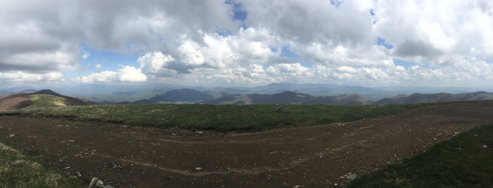
Max Patch

Crossing Virginia border to Damascus

   The second day out presented two of the most significant climbs for the week, both on the same day. The first climb brought me to the summit of 5800' Whitetop Mountain. There I ran into Ragawort again, who had camped 2 miles up from where I started. As I passed, he kept up with me for the rest of the day. We seemed quite matched for pace and endurance, and spent a fair amount of time hiking together over the next couple days. The second climb was over Mt. Rogers, then on to the Graceland Highlands, home for the 'wild' ponies. The horses are left on their own for three seasons, but are corralled and brought to farms over each winter. Consequently, they are easily approachable and have no fear of humans. A sign warns us to neither feed or pet the horses. I think of Sean nearly incited a stampede nine years ago when he offered a carrot to one or two of the ponies. At Elk Park, we found Trail Angels who offered us salads, fruits, cookies, sandwiches, and Gatorade. The gentleman had hiked the trail in 2013 and knew what we would crave most, so salads were first on the menu. They gave us small somemore packs with chocolate, graham crackers and marshmallows. We took advantage of this at Wise shelter that night.
Trail Angels at Elk Park Gap

   At 4 AM, the heavens seemed to open up and the thunder, and lightning. The deluging rain that rolled off the roof seemed to accumulate in front of us, making a moat (no alligators), and bringing into question whether or not we might need to swim to escape the shelter. It was a good day to turn over and go back to sleep hoping that in a little more time, the rain might stop. After breakfast, and as soon as I put the pack cover on, the rain seemed to suddenly dissipate! This has actually been a recurrent theme and observation leading me to conclude that my pack cover is magical. As the day progressed, the sun came out which facilitated the 20 mile hike to Trimpi shelter. This proved to be an old stone and mason shelter with a fire place built in the 1960's.
   The next day, I awoke to a strange blinding, glowing orb in the sky, something I had a hard time identifying at first, but later felt with some degree of certainty that it was indeed the sun.  After leaving in the early morning, I passed through several fields with livestock, (which is considerably better than deadstock!). The morning sun on the dew laden grass was beautiful to see, but my boots quickly seemed to fill with water.
   We hiked through a long climb to Partnership Shelter, located on the edge of the parking lot for the Park Headquarters for Mt. Rogers, on the road to Marion., Va. The shelter is new and heavily coveted by hikers as it can hold up to 16 hikers. There is a phone outside the park HQ building for hikers to make local calls, and yes both Pizza Hut and the local Chinese restaurant will deliver to the gate from town, (cash only!) Finally, the shelter has it's own shower! Usually, the water is heated with propane, but when I arrived, it seemed someone had forgotten to pay the bill. Undeterred, and facing many more days without a shower, I took a very refreshing cold shower in my hiking clothes (multi-tasking,) with only one consequence that George described so well on Seinfeld. I then laid out in the warm sun for an hour, drying and enjoying lunch, while most of my hiking companions went into town for resupply.
   After lunch, I continued to hike the last 6.8 miles to Chatfield shelter. A stream flowed in front of the shelter and there were several hikers there, none of whom I had met before. I apparently decided to make a spectacular entrance however to really impress them, and again fell spread eagled in the stream after stepping on a slimy rock. This once again earned me a score of 8.5 (damn that Swiss judge and his 8.5!). No permanent damage, but that did hurt, and an immersion of my lower extremities in the cold water did help. This is the one thing that all hikers fear: an unexpected fall causing enough trauma to take you off the trail.  So far, so good!
 
Ragawort on muddy trail outside of Pearisburg


  The next morning once again, I awoke early to the sound of pounding rain on the metal roof, though this time, there was no thunder or lightning. Once again, after donning the pack cover, and leaving at 7:30, the rain ceased, like Moses and the Red Sea. The day improved with the sun appearing later in the day. As I passed through Grossclose, passing under I-81.  I found some provisions at the wayside Shell station to supply me for the next two days that was not sugar, sugar, chips and candy. I bought two out of three Ramen noodle packages they had for sale. After my mad shopping spree, I went to The Barn, home of the Hungry Hiker Burger, which is not available at 9:30 in the morning. So I had an egg/bacon entree, sandwiched between two wonderful pieces of toasted Wonder Bread.  After this second breakfast,  I walked on to Knot Maul shelter and settled in for the night. There I met Slo-Poke and Hot-Rod, two middle aged, thru-hiking twins from Florida who passed through. I had heard of these guys and how funny they were from other hikers (reputation  travels fast). They did not disappoint. That night however, I shared the shelter with two young men. One of them had a snore that was Moe, Larry, Curley, all rolled up into one, and sent bears running for miles around. I can usually sleep through most shelter snoring, but not the case that night. Each of these guys had no sense of hiker etiquette, as they arrived late and were still night hiking at 9:30, well after the rest of us had gone sleep.  They then insisted we make room for them in the shelter and one stayed up well past 11PM, showing really no respect for other hikers there. They were both, of course, still sleeping in their bags at 7:30 the next day as I left.
   The day started out well for hiking with a bluebird sky and cool temps. I had wonderful views to the south with Mt. Rogers and Graceland highlands in the distance, as I climbed up through bald pasturelands. Despite a favorable forecast however, the day clouded up, and I had rain by the time I reached Wallace Gap. This time the pack cover could not save me, and the cold rain and sleet (at 4500') persisted. The ridge proved to be difficult footing and a tiring section to navigate with many short ups and downs before finally descending to Jenkins shelter.
   That night was a cold one once again, with a low in the upper 30's (really, Virginia?) That day was ideal hiking weather as the sun did stay out, but ineffectively as the temps never got above 60. We made a short day of this to Helvey's Mill shelter, in order to give myself a mini-rest day, arriving there at 2PM, allowing a nap, reading, and generalized goofing off.  The hiking traffic had really thinned out by now as everyone who cared was at Trail Days in Damascus. 
  The next day promised a room for rent with a shower in a store only a half mile off the trail, as long as I could hike to Trenten store and reach there early enough in the day. Once agin, I caught up to Ragawort, and we hiked most of the day together. I have to admit that if you hike with a companion who matches your pace, the conversation makes the day go by very quickly. I told him about the room for rent, and he agreed to go half on the rental. We  got the room which included a shower and laundry for $22.50  per person. We of course availed ourselves of the restaurant and had a great burger with fries that night and scrambled eggs the following morning.
Woods Hole Hostel, Pearisburg, Va.

We did set off early the next day as the weather promised intermittent rain for the next three days. Our goal was to reach the famous hostel of Woods Hole, and we knew the rain would bring everyone off the trails in search of a dry place for the night. I had wanted to stay here with Ryan 9 years ago, but the family had closed it 10 days prior to our arrival, as they felt Tilley, the grandmother, was no longer physically capable of running the operation. Fortunately, the grand-daughter Neville and her husband Michael took over the operation 2 - 3 years later and have transformed the place into a farm that is nothing less than awesome. This put a special spring in our step and we covered the 15 miles before 1:15 PM. Once there, we rewarded our efforts with a pint sized blueberry/banana smoothie. The hostel is a favorite with hikers. We stay in a barn with clean mattresses and fitted sheet. It includes a shower and for extra charges, they prepare dinner and breakfast. In a kitchen smaller than mine at home in Orono, they prepared dinner for over 30 people. There were over 20 cold frames, from which they picked the fresh components of a wonderful salad. The bunkhouse, as predicted, filled fast, and people were being turned away by 3PM.
Ponies in Graceland Highlands

The final day's hike was again foggy and damp, though no frank rain, as I made my way over the last 11 miles to Pearisburg. Ragawort left at 6:15, so I had no chance to wish him good-bye or safe hike. Hopefully we'll see each other again up the trail. This reminds me of the many chance encounters we experience on the trail, and the different people we meet. I'll return to the trail a week later, and the cast of characters will have completely changed. This is just another opportunity to meet more new trail people. We are all bonded by a common cause and purpose. Being unsuccessful in my attempt to secure a rental car in Pearisburg from the local Enterprise Agency, (who apparently have a reputation of never having any cars to rent), I arranged for a local shuttle with Don Raines, who brought me to Blacksburg. From there, a bus picked me up the next morning, and for $4, drove me the hour to Roanoke Airport. So here I am in Orono, on 'vacation' from my present job of hiking the AT. The timing of the visit is perfect for attending Sean's graduation, as well as being here for Kathy's 60th birthday. We'll be back on the trail as of May 27th.
Wild Azaleas


Sunday, May 8, 2016

May 8, 2016   Damascus, Va
  Well, it finally happened. We have now officially crossed into Virginia, leaving North Carolina and Tennessee in our rear view mirror. That means there is only 550 miles in Virginia to go before the next state crossing... that's a quarter of the entire trail's length! The weather has been not so nice. Most days we get a combination of clouds and sun, and sometimes a brief period of rain. Fortunately for me, most of the heavy rain happens at night, and also fortunately, I'm usually in a shelter safe and dry.. with the mice. We have not seen or heard from a bear so far, though I have talked with several hikers who are convinces they saw or heard a bear. One hiker states he was sure he saw a bear.. while he was night hiking without a light. Spring continues to progress, though you can go from leaves out and green in the lower elevations, to brown and still winter at 6000'.
  After leaving Erwin, I was driven back to Beauty Spot by my host Mike at Cantarosa Farm. Once again, it was beautiful, but much of the mountains were shrouded in low clouds and seemed to be promising rain.I pasted the picture to Facebook and wished my wife a happy anniversary. It proved to be a fairly easy hike to Unaka Mtn. It is amazing how much energy you can still have if you let a vehicle make all your elevation gain for you! The summit, once again unlike most high mountains in the south, is completely covered by a pine forest, making one think of the mountains in New England. After leaving the summit the heavens opened up with heavy rain for about an hour completely soaking me, though the pack stayed dry. There is a mantra that hikers know and that is that nothing dries on the AT. Later the sun re-emerged and we were at least partially dried. I passed Greasy Creek and resisted the urge to visit a new hostel, and with the stories that later emerged, I am probably happier for it as the proprietor was already earning a reputation as being a little eccentric. It is interesting how many new start-up hostels emerge, and how many established hostels have closed. There is a limited amount of cash flow brought by hikers who tend to be very conservative in their spending habits. I spent the night at a shelter refurbished as an eagle project with Odie, Just Drew, and Hollywood. We had to choose our sleeping site carefully  inside as it was obvious the roof leaked.  Never trust a boy scout! We did get another rip-roaring thunder storm and tropical-like downpours that night which toppled a couple trees, but no one in the shelter got wet despite the leaks.
  By morning however, the sun was out, and it was once again a beautiful day to cover the 16 miles over Roan Mountain to Overmountain shelter. The climb up Roan was cool but long to the 6285 foot summit, only 3 feet lower than mount Washington. There were views but the summit is again largely covered by a pine forest. On top, we met an older couple who were doing the trail angel thing by passing out candy and oranges and apples to thru-hikers.It was beautiful through Carver's gap and up to Grassy Bald, but once again, thunderstorms chased the hikers most of the mid-afternoon. The shelter is actually a barn erected at the time of the revolutionary war. Yellow Gap is famous as a group of constitutional militia crossed the high gap and surprised and defeated the British loyalists on the other side. At the shelter, more than 15 hikers eventually accumulated for the night. Their was a mother/daughter pair who had decided to spend a second night there. The daughter had recently been discharged from the military, but was dressed in combat fatigues, and was open-carrying a 45 caliber weapon. I guess we new who was sheriff. Most authorities highly recommend that hikers not carry weapons by the way. Although they had the intention of doing a thru-hike, they had decided to quit the next day and family was picking them up. One less gun on the AT to worry about!That night, the rain was once again on and off, Although I was down below on the first level looking out over the valley, the women and the rest of the hikers were on the second floor. I had the misfortune of having a young overweight hiker sleeping directly above me who obviously had obstructive sleep apnea, and snored so heartily, the barn shook, and with that shaking the dirt on the floor under him found the passage through the cracks in the floor to my place of sleep, head and mouth! At 4:30 AM, I heard the two women up talking and laughing in full voice as though they were the only ones there. At 6:30, I awoke to smoke inside my sleeping bag. Looking out the two women had decided to start a fire on the dirt floor, ... inside the barn, preferring not to chance getting wet by using the designated fire ring. I quickly told them that this was an ill-conceived idea as a 200 year old barn would go up like a box of matches if it caught fire not only putting themselves in danger but also all the hikers still asleep above. They did comply and moved the fire to it's appropriate area. Several others were up but it seemed I was the only one to speak up; maybe the gun had something to do with it!
  That day of hiking, I braced for what I thought the weather predictions were for heavy rain. However, this once again never materialized. Going over the multiple grassy balds, the fog was thick, and I had sporadic showers, but no heavy rain. It was somewhat erie being out there alone and I thought it was likely similar to the Scottish Moors. At he end of the day, I arrived at Mountaineer Shelter, named after the adjacent falls which was the water source. This was a newer shelter built 10 years ago with the anticipation of more thru-hiker traffic. We fit over 15 people in the shelter, and still three others had to tent with the full house.
  The next days hike of 17 miles brought me to the famous Kincora, run for 30 years by Bob Peoples, who is an AT legend. He has been a force in trail maintenance and rerouting projects on the trail from Tennessee to Damascus. He built that new Mountaineer shelter. Nine years ago, his place was full and Sean and I had to tent. This time however, there were only 5 or 6 other hikers. The place had been let go a bit. He took in stray cats and provided a home for which the cats returned the favor by peeing on the hiker mattresses. There was a light out over the shower and I'm convinced this was a divine blessing so I could not fully see what was growing at the bottom of the shower. I did stay because he was a nice man, and I thought he deserved some hiker respect. I did get by and did a laundry and got a shower. Bob took us into the small town of Hamilton, Tn. for resupply where I bought a frozen pizza for dinner, and frozen burritos for the next days breakfast. The things we compromise in terms of niceties and diet while on the AT. The bar is obviously much lowered.
  After exiting Kincora, I made my way for Vandevetter shelter some 18 miles away. There was a stiff climb up and down Pond Mountain before starting the climb up the massif to  4500'.Once again the predictions were for a rainy day, but in the morning, the sun actually appeared. The air continued to be unusually cool, but excellent for hiking. In the process, I passed by Watauga Lake, a man-made lake in the TVA system. We were told not to camp or loiter at the lake as there had been a pesky bear problem. They had closed the shelter to camping for two years due to this smart bear. They had briefly reopened it earlier this year but like Yogi, the bear returned to pull his old stunts on the unsuspecting campers.. and mister ranger did not like that! I crossed the dam, and followed the ridge line up for miles giving outstanding views over the lake, arriving at the shelter by 4:30. At  6 PM, it started to rain with only four of us at the six man shelter. Then the hoards arrived starting at  6:30. We had 12  hikers all  wanting space out of the rain in that tiny shelter. We managed to squeeze in 8, but the rest had to set up their tents in the falling rain and falling temps which by then were in the mid forties. A fog  descended on the mountain, and all night the wind blew the rain and fog  into the shelter. Everything was damp in the morning. The temperature fell to 38' that night. I ate a brief breakfast, then got on the trail feeling that exercise was the best way to ward off hypothermia. Unfortunately within the first hour, I slipped in the mud. Once a 30 pound pack has momentum in the wrong direction, it's taking you with it. At this point I did a full spread eagle on the muddy trail. Fortunately neither my clothing nor any body parts were injured in this technical acrobatics which earned me a 9.9 score.The entire day, I was in the wind and a cold fog until I descended in altitude. I stayed at Double Spring shelter with Big Bird, a retired airforce helicopter pilot, and Vanderwort, a section hiker now committed to finish the entire trail now that he had retired from Publix Market after 40 years of managing the bakery section.
  The next day was a surprisingly quick hike of 18 miles to Damascus and the Virginia line. As I reached the sign post, marking the border, divine providence sent a troop of boy scouts, who were tech-savvy enough to use my phone and take my picture with Wilson. The first night here, I stayed in a hostel called the Place, run by the Methodist Church. Tonight however, I get a bed to myself (king-sized) in the Hikers Inn. I've spent the off day mostly stocking up on calories and enjoying the town. Plans are now to try to complete the 160 miles in 9 days and reach Pearisburg, Va, then drive to Roanoke and fly home for Sean's graduation, resting a week at home with family before returning to the trail.


Saturday, April 30, 2016

April 30, 2016   Erwin, Tn.
  We are now 70 miles closer to the Virginia border than the last post. I have about 120 miles till I reach Damascus, and the 550 miles ( a quarter of the trail), in Virginia. I arrived here yesterday with the intention of staying only one night before leaving on the trail north again. Just before my arrival, I learned of the hikerpalooza/outdoor sports days this weekend here in Erwin. Most hikers stay at Uncle John's, who runs a hostel 200' from where the AT lets you out on the bridge over the Nolichuckey River. This was to be the epicenter for the hiker bash. At the time, I was just feeling anti-social, and just wanted a place to share with no one, so I booked a cabin to myself down the road at the Cantarosa Farm and Apiary. Being a close relative to a simian, I thought I would fit in nicely, then I found out it meant bees. The owners Mike and Peggy are nice people and have been very accommodating. It was Mike who suggested I slack pack north to Beauty Spot, and spend one more night off the trail, on a mattress, with a shower all to myself. The lure was irresistible.
  We left Hot Springs as planned via a shuttle to Allen Gap, by-passing 15 miles of the trail which was affected by the fire. I rode with Dan, the owner of the outfitter store, who drove us, and one other thru-hiker, Robo-cop, a retired LA policeman who had done the PCT twice. At the top we met two other younger hikers dropped off by their Dad, and had the misfortune of reaching that gap the day prior, and mistakenly hiked south into the fire. They were stopped at the next gap by fire personnel, but had to walk down the gap 10 miles before they could again be picked up by the parent who had misdirected them in the first place. Never trust a Dad for directions!
  It was impressive how blackened the mountainsides were from this fire, and how thick the smoke. From there it was a 2500' climb to the open rock ridge where we met Trixie and her boyfriend who had done trail magic the previous day at Devil's Fork Gap. We stopped short at only 12 miles of hiking and stopped at Jerry's cabin.
  We think we were ahead of a bubble of hikers in Hot Springs who had been unexpectedly delayed. It seems that one of the local quick-marts was closing and threw out more than 35 cases of beer in the dumpster. Word of this good fortune spread fast among the hikers and the next thing you know it's a beer-a-palooza on the grounds of the resort. It seems likely that more than one of them took an extra zero day the following day. So the shelter this time was not crowded at all. We did meet a new friend Olive, a 7 year old black lab, and Olive's human, her traveling companion. That night it rained very hard for no more than 15' at a time, but the moon was out for the 3 AM pee break. One of my new trail mates, 'Pirate', a young Venezuelan, got up at 4AM, ate, packed and left and has not been heard from since. The circumstances of his departure remain a mystery.
  That next day was fair and a good day for the 9.5 mile hike to Hikers Paradise, the hostel at Devil's Fork Gap. The proprietor, Jerry, was very nice. He was trying to cobble together a hostel out of a very limited building space. The bunks were three high and I wondered if the top bunks came with a box of tissues for those susceptible to nosebleeds. He did have a nice selection of junk food, and went out and bought beer for which we chipped in. We wanted him to buy us a box of burgers, but instead, he bought the burgers himself and charged us $5 a piece. Still, it tasted very good! That night there were intermittent severe thunderstorms making me glad I was inside. Unfortunately in the cramped space, sleep was poor as the dog kept groaning, snorting, licking and other odd noises all night long.
  The next day the rain had passed, and it got nicer as the day went on despite the prediction for more T-storms. It was a beautiful hike gaining the high ground once again. As the trail gently sloped up the steep contours it looked as though it was a dirt suspension bridge precariously suspended from the uphill side of one large tree to another. I covered another 16 miles that day to Big Bald, and shelter, one of the highest shelters on the AT at 5800'. The view was once again spectacular and the air had largely cleared of most of the humidity. The Smokies were clearly visible, and seemed a million miles away. I walked for much of the day with Fargo, a native Floridian, with much hiking experience. We had lunch together, but I left him alone with his cell call home to his girlfriend and continued up the arduous trail to the summit of Bald Mtn. at 6275, 13 feet lower than Mt. Washington. I stayed at the shelter which could hold 10, and in the late evening, another 5 joined me, as well as a Dutch girl who set up her hammock. One person in the shelter with me was Hazelnut, a solo woman hiker from Bridgton, Me.
  The next day I got up extra early to cover the 17 miles to Erwin. I wanted to get in early enough to shop, and check in. The day was once again spectacular and the air went from quite cold  in the higher elevations to what felt hot at 80' by the time we got to town. As I started out at 6:45 AM, the last half moon was setting. I passed several tents farther down the trail still occupied at 8:30. Many of the 'party' hikers seem to sleep late, smoke and get high, with the intent of just making trail days the second weekend in May in Damascus, Va. But enough about me...
  Today the hike felt like cheating as the car brought me to elevation and I hiked back to town and down the 4000' loss. I met Brother Tom at Indian Grave Gap who is out there 6 days a week distributing trail magic. (Sundays excluded). I sat and talked with a few hikers for a long time before resuming the hike. At the next shelter I once again ran into Ranger, an eagle scout who had worked one or two summers at Philmont Scout Reservation in New Mexico, and actually wore most of his uniform as hiking clothes.There I also met a new girl from Sidney, Me. On the way down I had the misfortune of having one of my brand new poles suddenly break in two. The traveling fix-it guy at John's indicated it would only be fixed by Black Diamond, but indicated the Z poles have had a lot of problems over the years and should probably not be used by thru-hikers. I ordered a new pair of Helinox poles the the Walysi Center in Georgia, which will mail them to Damascus. In the meantime, I may be walking a little lop-sided. I'll deal with Black Diamond later.
  That's it for now, and I hope to zero and update again in Damascus in the next 7 days, before the hoard of 10,000 people arrive for Trail Daze.


fork Gap.