June 1, 2016. Daleville ,Virginia
Well, more of the same has been going on since I resumed the trail 6 days ago in Pearisburg. I took a wonderful week off and returned to Maine for Sean's graduation from UNE COM. It was wonderful to see family and be home again. We also accomplished a few other things as well. I was able to get over to see my mom who was recently discharged from the hospital after another bout with infection. I got out to camp and got the furniture out, the screens up, the water up and running after finding a huge hole in the copper piping where water had pooled and frozen over the winter. I also got the dock in. At home, I got two cords of wood stacked in the woodshed. Despite the pleasure of being home with my wife, each day there was a sense of unease, like I needed to be doing something else..... like hiking.
Traveling on a plane, I had to be sure may white gas fuel bottle was empty. As it happened, TSA inspected my backpack both coming and going to be sure I was compliant with this. Before going back, I wanted to be sure I could refill the bottle before resuming the trail. I must have called 10 businesses in Pearisburg, even Walmart, and all were out of white gas and expecting a delivery. When I landed in Roanoake, with a rental car at my disposal, I quickly shopped at nearby malls for food and found a Dick's Sporting Goods. So 700 cc's of fuel cost me around $14, and thus I had to bite the bullet and bought the entire gallon of Coleman fuel, leaving the rest to the hiker box at the B+B I stayed at in Narrows. Now at least one place in the greater Pearisburg region has white gas. I have since found out that I could have used super unleaded gasoline as a substitute, though MSR does not officially condone or approve of the practice. Who knew?
In Narrows, Va, I stayed at a wonderful B+B, The MacArthur Inn, named in honor of General Douglas MacArthur. This place was beautiful. Built at the turn of the century, it started out as a hotel, but ended up as a nursing home residence. It was condemned as a a structure unsuitable for this purpose in the 1970's, and was slated to be torn down. The proprietor, Alan, bought the place and with tender-loving care has restored the building back to it's original intent as a hotel. Alan was a crusty southerner, with a handle bar mustache, a good heart and a love for hikers and the AT. We shared a bond over restoring old structures. The next morning, he made each of us an omelette, one at a time. It was delicious, and because of the slow, individual production of each breakfast plate, this did take time, and lead to a late start. I was able to return the rental car to the Enterprise in Pearisburg, then get on the trail by 9:30. Interestingly, in addition to not having any availability to rent cars out of the town, there is also apparently no one working there as the employee had not shown up a half hour after opening time. So I left the key on the desk with the rental agreement and bolted. Message to self; never trust Enterprise Pearisburg again!
The first day out was quite warm and now humid, a dramatic change from a week before. I decided on an ambitious itinerary of hiking 20 miles to Pine Swamp shelter. What I hadn't counted on was a degree of interval deconditioning from not hiking in over a week. The hike out of Pearisburg was long and posed a significant gain in altitude. On reaching the ridge, I went through an area that had no green leaves or anything else green for that matter including the forest floor, likely as a result of very hungry gypsy moth catapillars. There was one improvement though: the mud was significantly reduced. It was a long day, and I pulled into the shelter at 6:30. There I met a family from Georgia; Mom, Dad, about my age , and their three grown children with their significant others. Most occupied the shelter, but there was a spot for me. They were section hiking together to McAfee's Knob. The father did all the planning, and did most of the food planning, dehydrating, and vacuum packaging. The re-hydrating and cooking turned out to be a little variable with regards to it's intended outcome, but they all ate the food none-the-less. They also were hiking with a black lab, who snorted, licked, and made noise all night long, leading to a restful sleep for myself.
The following day was also challenging with two separate climbs to 4000', each climb over 2000'. The profile made it look like the walk on top of the ridges would be flat and easy. It did not turn out that way as there were rocks, big and small to contend with and challenge my balance. You have to be carefully watching each and every step, playing hop-scotch with the rocks to ensure your footing is firm and you don't twist the wrong way and fall. I missed my footing on one occasion and fell at an innocuous looking spot, bending the tip of my new pole on impact. I was able to restore functionality, and bend the pole back mostly to straight. Once again, the fall looms as the hikers worst nightmare and adversary. The day was also very warm and humid with dew points around 60'. I went through 5-6 liters of water that day. Rule of thumb: keep the pee as pale as possible! The second climb of the day at 3 PM was miserable, hot and slow. This time though, the ridge was very easy terrain, as was the descent to Laurel Creek shelter. At the road crossing prior to this last climb, I found trail magic with fruit, candy and drinks. I stuffed in my pack what I though was a large red and white can of coke, only to find upon arrival at camp, that it was a Bud, with a July 4th holiday label. I would have preferred coke.
The next day was overcast on awakening, but it stayed dry. Because of the unusual spacing of shelters, I had to do a 22.5 mile day to stay on schedule. Pickle Branch shelter was the only shelter in a 25 mile stretch. The big climb of the day once again was difficult with the muggy conditions. Once on top, the walking was easy. For many miles, I saw areas where stones had been meticulously piled, likely meaning this had once been a field that a farmer had cleared by hand. The farm land had long ago been reclaimed by the forest. We also climbed Bushey Mountain later in the day, and the walk across the top was a fire road, a welcome relief to the feet. Any rain activity seemed light and it confined itself to the night-time hours.
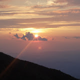
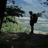
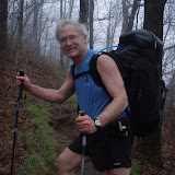
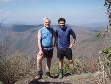
The next day looked on paper to be easier, and shorter, only 17 miles. However, the first part of the day was a stiff climb to Dragon's Tooth. As I got higher, the sun came out and I noticed undercast clouds, from condensation of muggy air. The walk across the ridge to Dragon's Tooth was very difficult footing and slower than usual. The view there was spectacular however and worth the effort. Many thru-hikers had camped on top and were making a leisurely morning of it. The first mile of descent was also a rock scramble. By 12:30, after 5 hours of hiking, I noticed that I had only gone 5-6 miles, well off my usual 2-2.5 mph pace. The terrain had been surprisingly difficult. The rest of the day brought me to McAfee's Knob. Reaching the gap and parking lot (on Memorial Day), there must have been 200 cars, (and no trail magic). I found myself on a well traveled fire road with all the tourists and could not believe this was the AT. About a half mile further and upon further questioning of a returning day hiker, I found out that I had missed the turn off for the AT which paralleled the fire road to the same destination. So at that point I could have a) retraced my steps and taken the AT; b) bush-wack down a 45' slope and try to find the AT; or c) keep going. Which to do?... c) of course. A little blue blazing never hurt anyone, and after being beaten up by Dragon's Tooth, it was nice to take the 'easy' way. McAfee's Knob was spectacular, despite being overwhelmed by the tourist traffic. I managed to get a few impressive pictures of myself on the knob with Wilson.
The shelter was less than a mile away north off the mountain. As the shelter beyond was closed due to a pesky Yogi Bear, this lead to a bottle-neck of a large group of hikers staying the night. I met a girl who was thru-hiking and had been working for the Green Mountain Club. We had a nice chat about the Long Trail, and adventures there with bears last year. Two hikers were in camp for the night who were somewhat famous in the thru-hiker bubble. One hiker was detained on several occasions by the Hot Springs Police Department, and he claimed abuse of power and authority. The other hiker seemed to have a similar story and actually eventually became friends with the mayor of the town. One of them also seemed to confirm the rumors we had heard that an angry hiker, harassed unnecessarily by police in Hot Springs, had set off the forest fire there.
The final day of hiking 15 miles into Daleville brought me to Tinker Cliffs early in the morning. Again the view was spectacular. The rest of the day was uneventful, reaching town by 3:30 for a shower, laundry and dinner out. There I once again ran into 007, a Brit hiking sections of the trail, confounded by orthopedic medical issues, and I had seen in several towns along the way, We had shared our first hitch ride into Hiawassee, Ga. two months ago.
I have now planned out the next 140 miles which will bring me to Rock Fish Gap and Waynesville, Va., the gateway to the Shenandoah Mountains. My adventurous daughter Meghan will join me there on June 14th for the next hundred miles. She will be the last of my children to be tortured by Dad with a long distance hike, but a time which I greatly look forward to.
Subscribe to:
Post Comments (Atom)


No comments:
Post a Comment