Another 4 days on the trail has brought me to a resupply point in Glasgow, Va. I hiked in the remaining two miles from Matt's Creek shelter this morning to the town making this a 'Nero' day, that is a day almost all to myself without thought or effort of hiking. Sean and I stayed here 9 years ago in a small no-tell motel, but this has since closed. Several businesses in the downtown are closed and have been for several years. For hikers however, the town and a boy scout troop, as an eagle project, built a 12 person shelter, complete with a hot water shower and two porta-potties, Nirvana for the average thru-hiker. There's a laundry down the street to complete our experience. While coming here, I crossed the longest pedestrian bridge on the AT across the James River, built on old abandoned railway pilings. As I reached the opposite shore a shuttle was just delivering two hikers to the trail assuring me of a ride into the town 6 miles away. One of the hikers was 'Fern', a young girl who is from Limerick, Me, and graduated from the University with a degree in kinesiology 3 years ago. It is amazing how many Maine hikers I have met out here so far!
 |
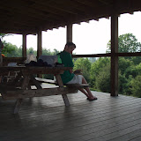
| Pedestrian bridge over the James River |
Since leaving Daleville, Virginia has dished out more of the same. The terrain has been difficult, more difficult than I remember, and the weather very humid, which means I am very moist at the end of the day, and in desperate need of a shower by the end of 5 days. Passing by the first shelter out of town, I spoke with a young family on a section hike, with an 11 yo and a 4 yo boy, Josh, who seemed to be a handful! They had found mold in their rented apartment, and were out to clear the air a bit. The youngest had asthma, and since leaving the apartment, while the problem was being fixed, he had required no treatment. Dad was carrying a 4 person Coleman tent, and most of the younger boys possessions by the end of the day. They traveled a little slower, but we did share the same site that first day out.
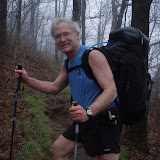
At the shelter I once again came across Arkansas Traveler, with whom I had hiked over three weeks ago. I also hiked several days with 'Popeye', a 66 year old retired vending machine repairman, from Florida, who recently had suffered a stroke, which left him with a facial droop, but did not prevent him from hitting the trail with the idea of finishing a thru-hike. He carries a Popeye figurene. As I watched him walk, I admired his resilience and courage, as it looked like a struggle for him. Yet even with his mild disability, he was up every day at 6 AM, and put in the same 17-18 mile days I was finishing. He had been off the trail a week due to a deep seated infection in his great toe from an infected blister.
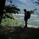
The second day brought me across the Blue Ridge Mountain Parkway, the first of many crossings over the next 200 miles, of either the Parkway, and later the Skyline Drive through the Shenandoah National Park. The AT originally followed the same ridge of mountains from North Carolina as the Parkway, but was shifted to the range west in the 1930's and 1940's when the parkway was built. The weather was good and much cooler at the 3500' feet elevation. The humidity created an amazing undercast of clouds down below in the valley. The second day brought us to Jennings Creek, and a private campground. They had a pool and showers (never pass up the opportunity to take a shower!), as well as a concession stand, with great hamburgers and fries, with ice cream for dessert.
I spent much of the next couple of days hiking with Bob, 'Good Heart', who was doing a section hike to Harpers Ferry. He had recently retired from teaching as a computer instructor, but employs 35 people in an IT firm. His son too was an eagle scout and both he and his son had gone to Philmont, in New Mexico.
It was at this location that we learned the Thunder Hill shelter and all camping for 18 miles was closed due to problem bears... bad Yogi!. This forced us to do a short day of hiking to Cornelius Creek, then a long day of 18 miles to Matt's Creek. Despite the relative assurance of guide books showing not much up and down, the amount of climbing proved difficult and repetitive. Though the temperature was reasonable at about 75', the humidity was excessive, and by the time I reached the shelter, I looked like I had jumped in the lake... which I would have gladly done if one had been nearby. There was a full shelter and many other tenters that night, over 20 in all. All of us were bottle-necked here by the 18 mile closure to camping coming up. That night, there was an amazing light and thunder show. The rain came down in torrents and the sky was literally constantly alight with lightening. Luckily none of the tents washed away and all survived the night. As I was in the shelter that night, I thanked my lucky stars for that good fortune.
The next day, initially looked threatening, but improved as the day went on and never really rained on us. Again we had several short hard climbs, followed by downclimbs. I climber over Apple Orchard Mountain at 4225, the highest we will get yet again to this level will be Mt. Mooselauki in New Hampshire. This mountain once served as a base for a radar installation during the cold war that monitored air traffic up and down the east cost. It is now a communications station for cell and TV. Arriving at Matt's Shelter, there was a rushing stream with deep enough pools to sit in and wash off, a welcome relief.
Unfortunately, the only restaurant in town is closed on Mondays, so I plan to hang around tomorrow for a 10:30 brunch, then hit the trail to finish another 10 miles out of the 77 remaining over the next 6 days till I reach Rockfish Gap, and Waynesville. There Meghan plans to join me on the 14th for the next 103 miles. More blog to come at that point!

No comments:
Post a Comment